Go back to Mali.
Go back to Voie Guy Abert.
Aiguille Panoramix.
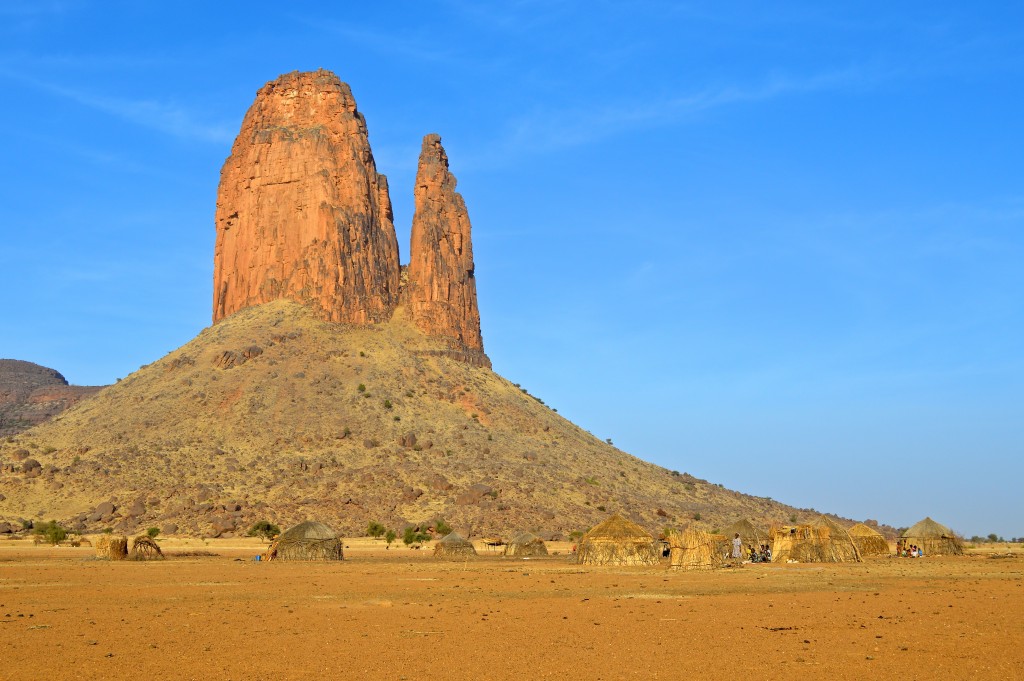
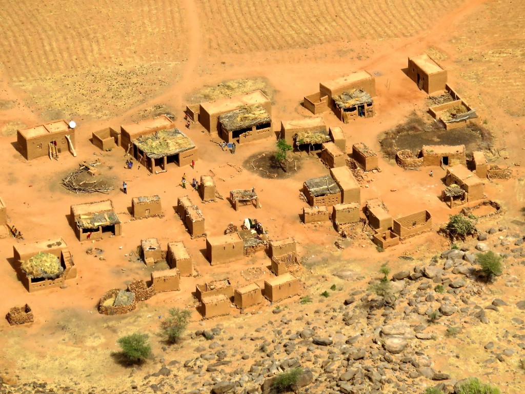
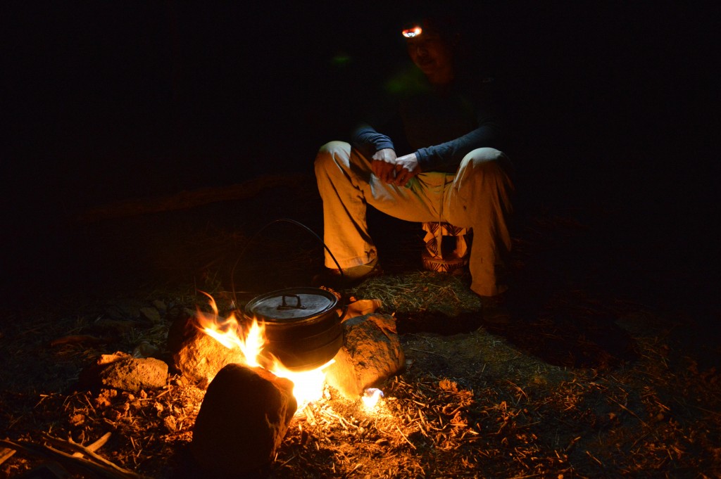
In the morning, we drove quite literally cross country (with a few dirt roads) to the village of Grimari – Dapana (Luggel) at the base of a cluster of smallish towers. After Main De Fatma, most towers seem small. We have been ruined. Here we climbed the largest one of the bunch called Aiguille Panoramix via its Samivel route (5-ish pitches and 5+). Much chimney groveling leading up to an improbable looking summit pitch…which turned out to be 3rd class on the backside of the tower. Best part of the climb were the views from the chimneys and especially from the summit. Another night in a village – this time in Youna and more chickens losing their lives and filling our stomachs. We explored the hundreds of years old and long abandoned cliff-side dwellings an hour’s hike above Youna. Something akin to Mesa Verde back in the US.
.
Women pounding millet.
Next day, we drove 30 minutes out of Youna and hiked up to a mountain-top village of Koyo-Boni. An amazing experience. The village is essentially self-sufficient – growing much of its food on the flat topped mountain and raising its animals (cattle, goats and chickens) with only two apparent ways in: the “backside” trail we used (long hike) or a 3rd class scramble (via hidden chimneys) from the town of Boni below. This latter option can be blocked off easily by the villagers with some boulders in case of trouble. We had earlier toyed with the idea of visiting Boni to see their market but Salvador’s contacts warned us of some unknown elements in town and so we just admired it from our high perch some 2km away. We went back to Youna for a second night.
Photos
A quick coffee and breakfast by the school in Fetendoti (Dec. 2015).
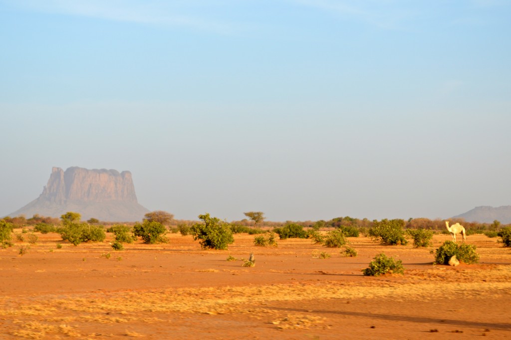
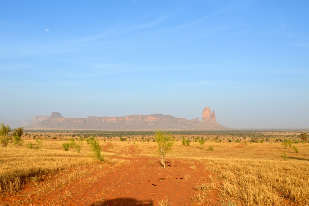
From Fetendoti, we headed out back into the open Sahel with views of amazing rock towers, mesas and walls as well as an occasional camel (…I mean dromedary).
We stopped off at a place in the middle of nowhere (seemingly) where people drilled shallow wells for water (Dec. 2015).
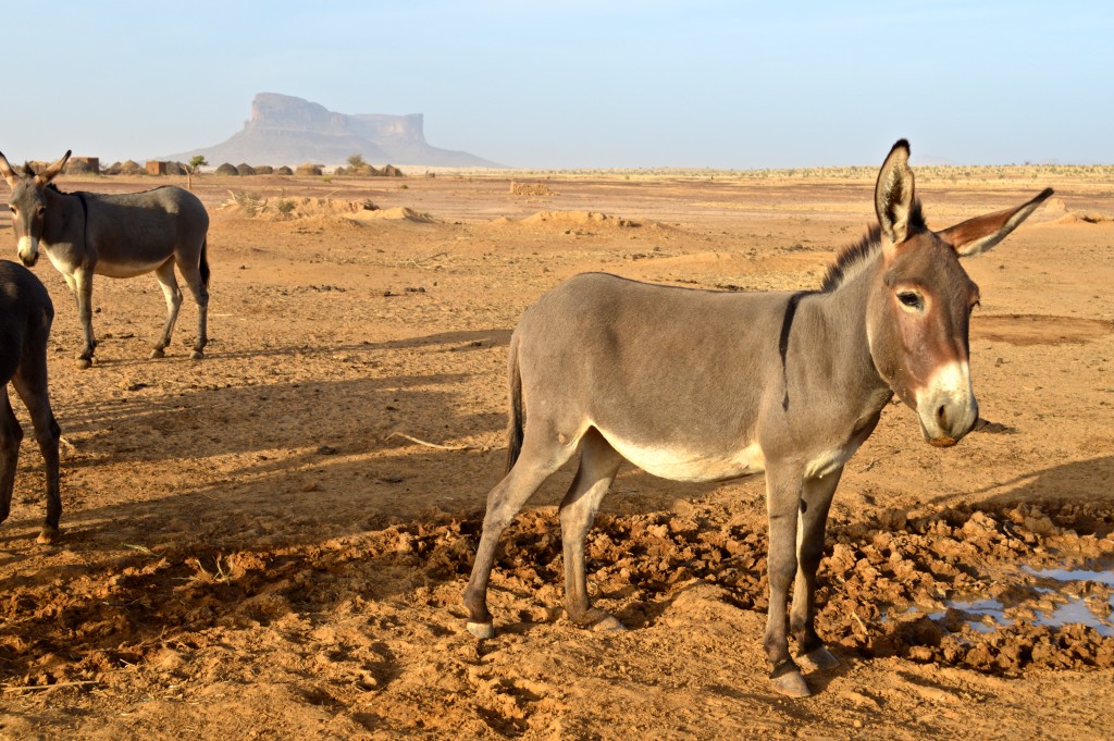
An ass.
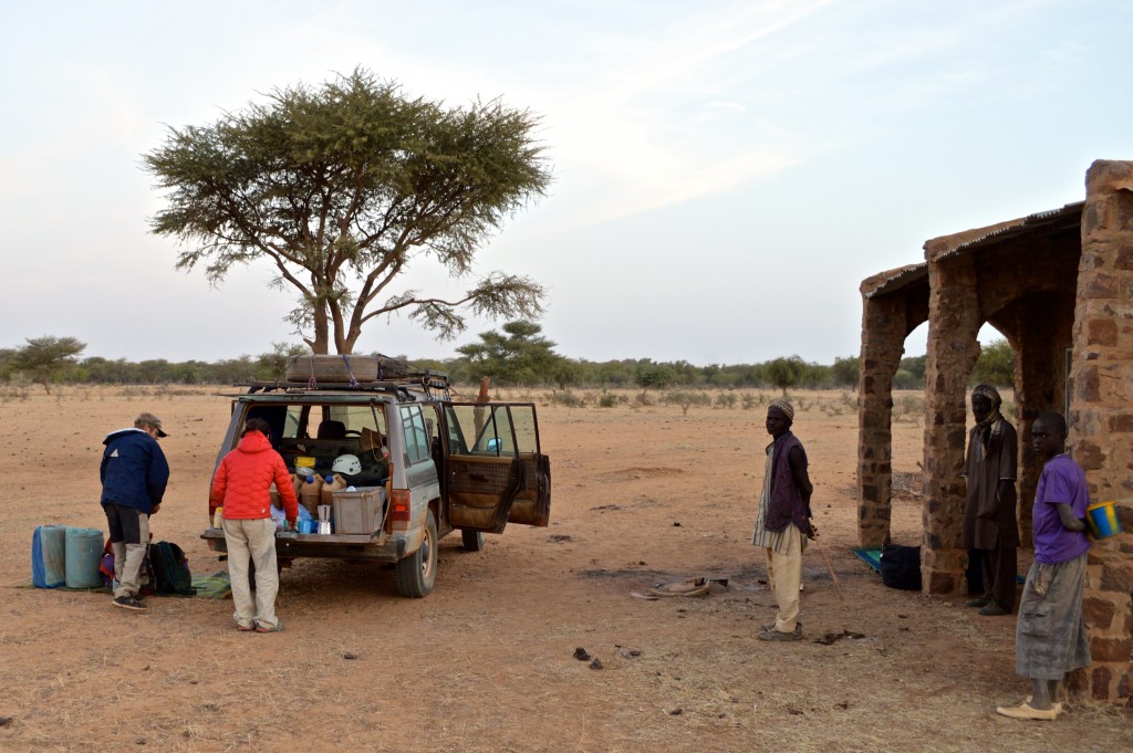
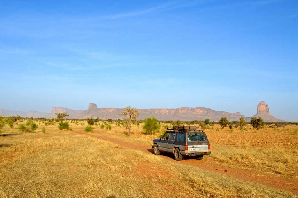
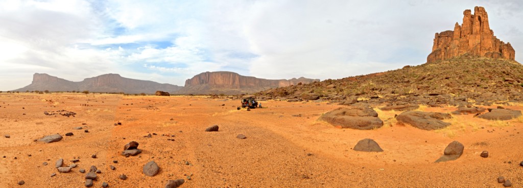
More “road” trip scenes from our morning in the Sahel (mostly off-road and cross country). Click photo for a video.
The scenery (Dec. 2015).
More amazing views (Dec. 2015).
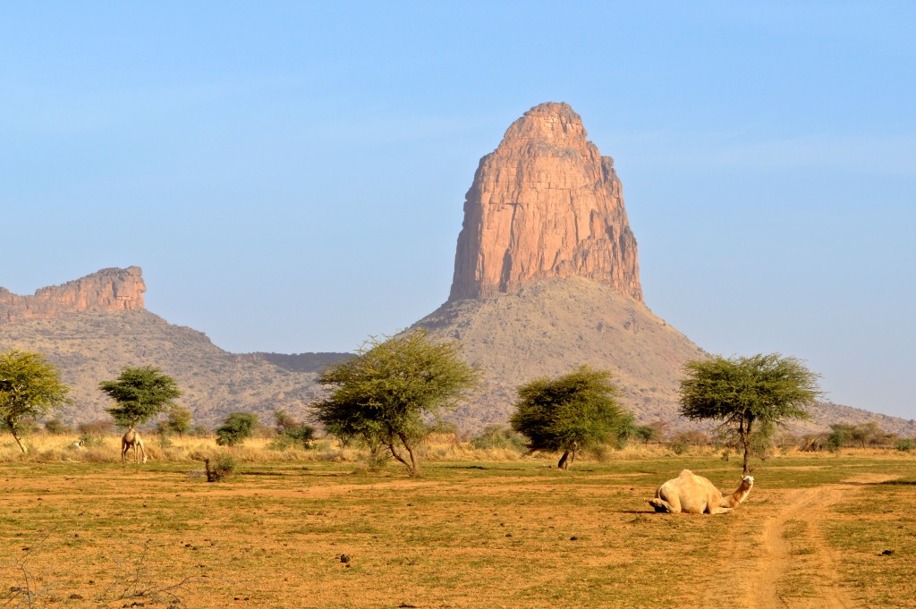
Just another 1000 foot tower behind a Peul camp…
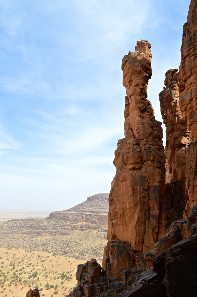
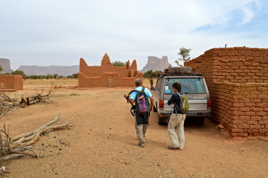
First view of Aiguille Panoramix – the tower at center of photo with a left-pointing horn of a summit (Dec. 2015).
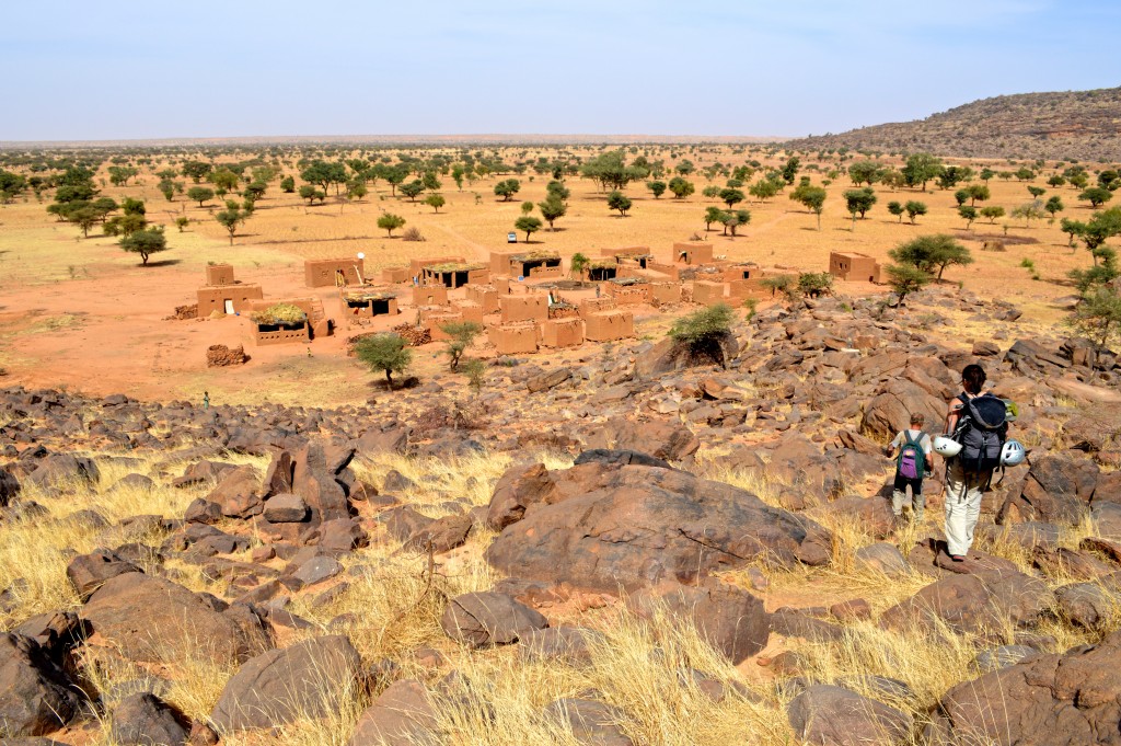
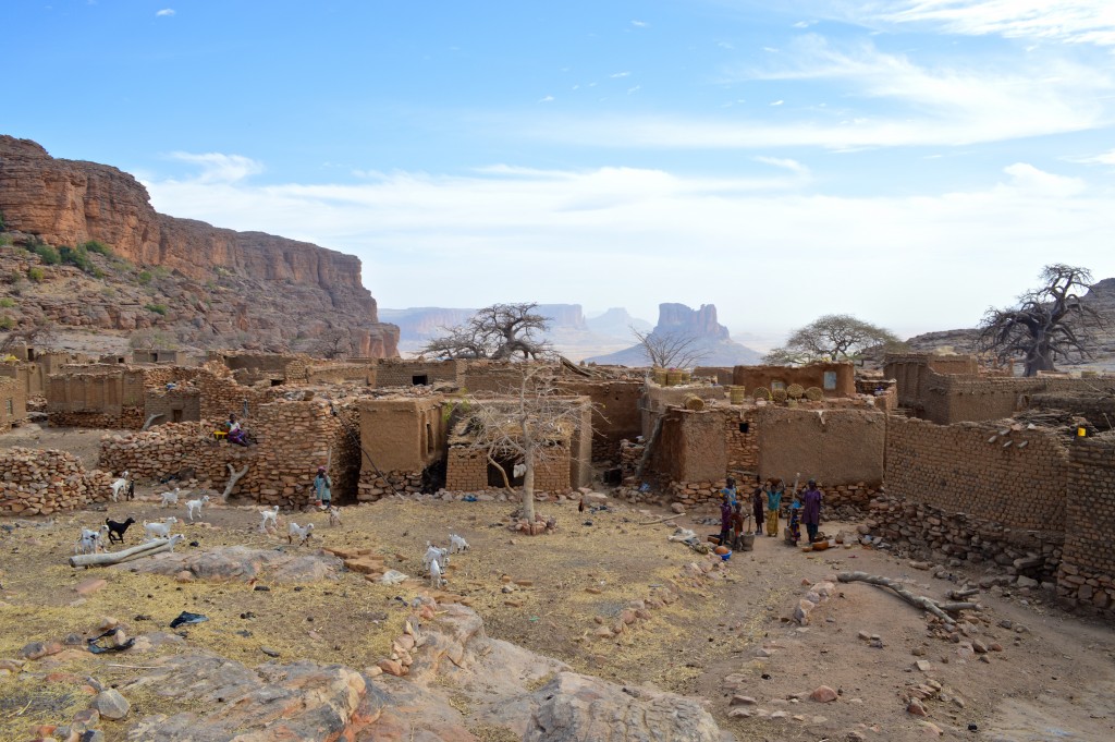
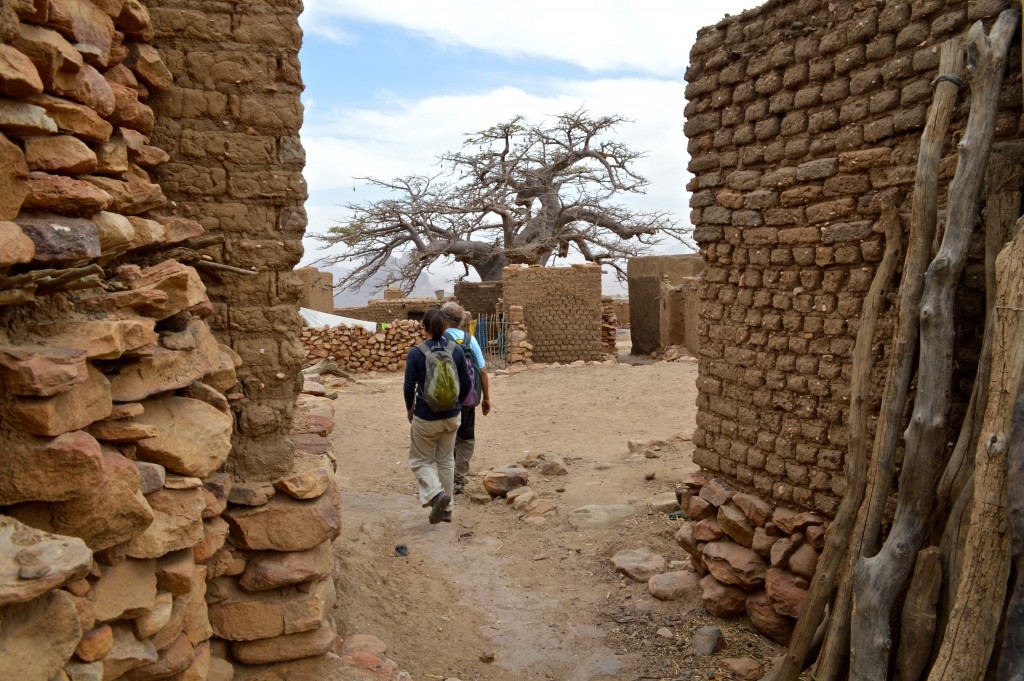
Shirley and Salvador hiking through the small village of Grimari-Dapana on our way up to Aiguille Panoramix (Dec. 2015).
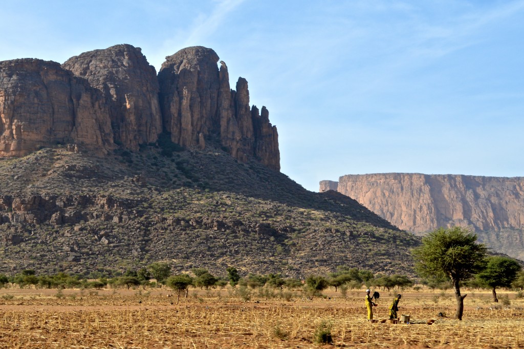
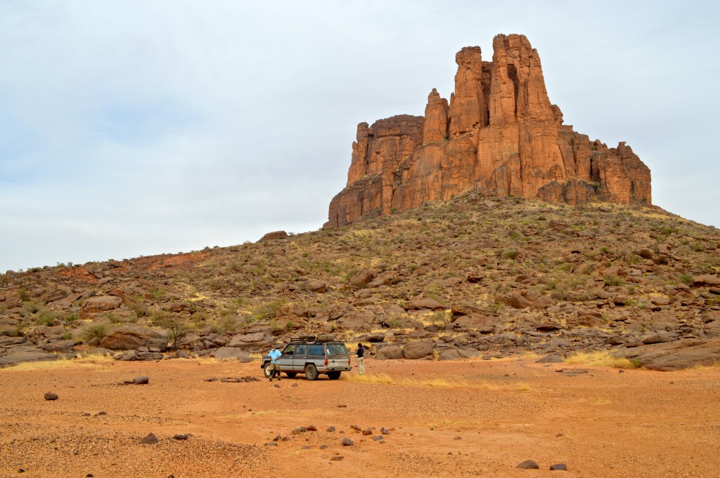
Aiguille Panoramix is the tallest tower at center of photo. Samivel route follows the chimneys between the tower and the parent cliff to the left (Dec. 2015).
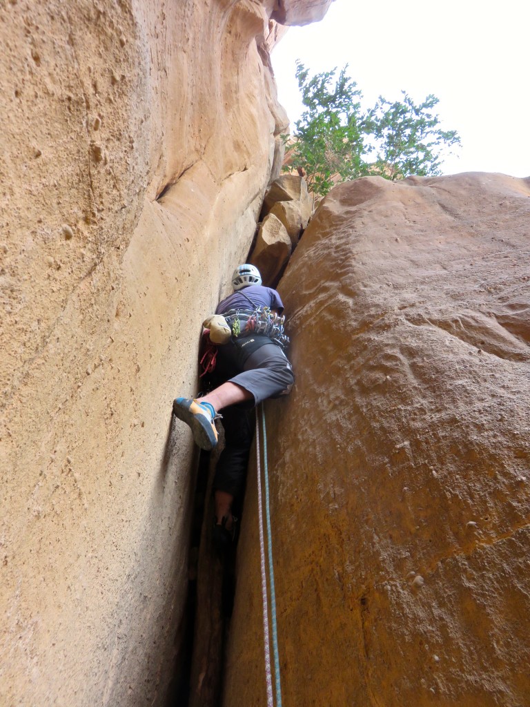
Starting up the first pitch of the Samivel route on Aiguille Panoramix (Dec. 2015).
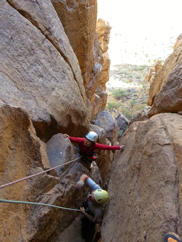
Shirley and Salvador topping out on pitch 1 of Samivel (Dec. 2015).

Leading pitch 2 of Samivel (Dec. 2015).

Looking back at Shirley and Salvador from the lead of pitch 2 (Dec. 2015).
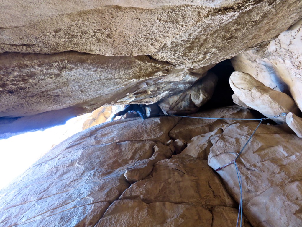
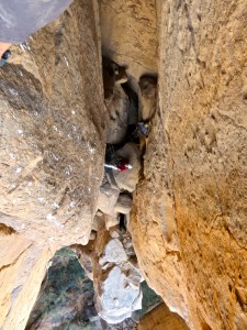
Exiting the cave on the same pitch using some chimney moves (Dec. 2015).
Looking out of the chimneys somewhere on the lower half of Samivel route on Aiguille Panoramix (Dec. 2015).
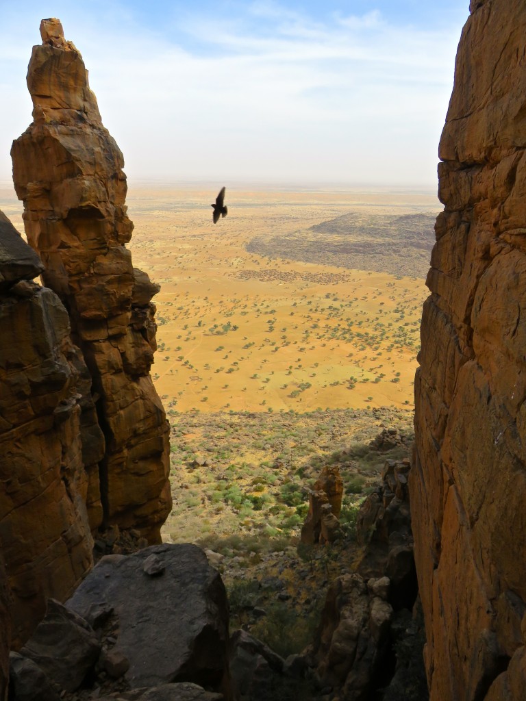
Looking back down at the village of Grimari-Dapana from the summit of Aiguille Panoramix (Dec. 2015).
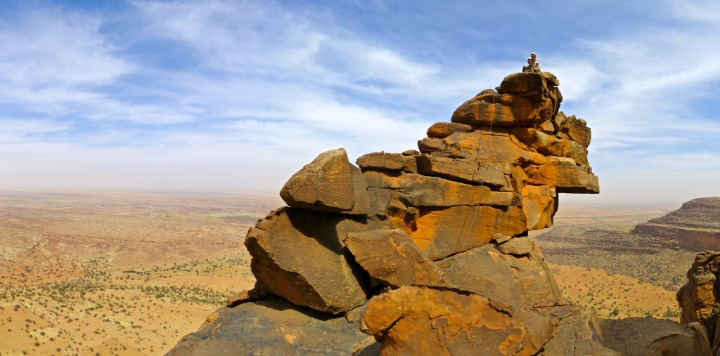
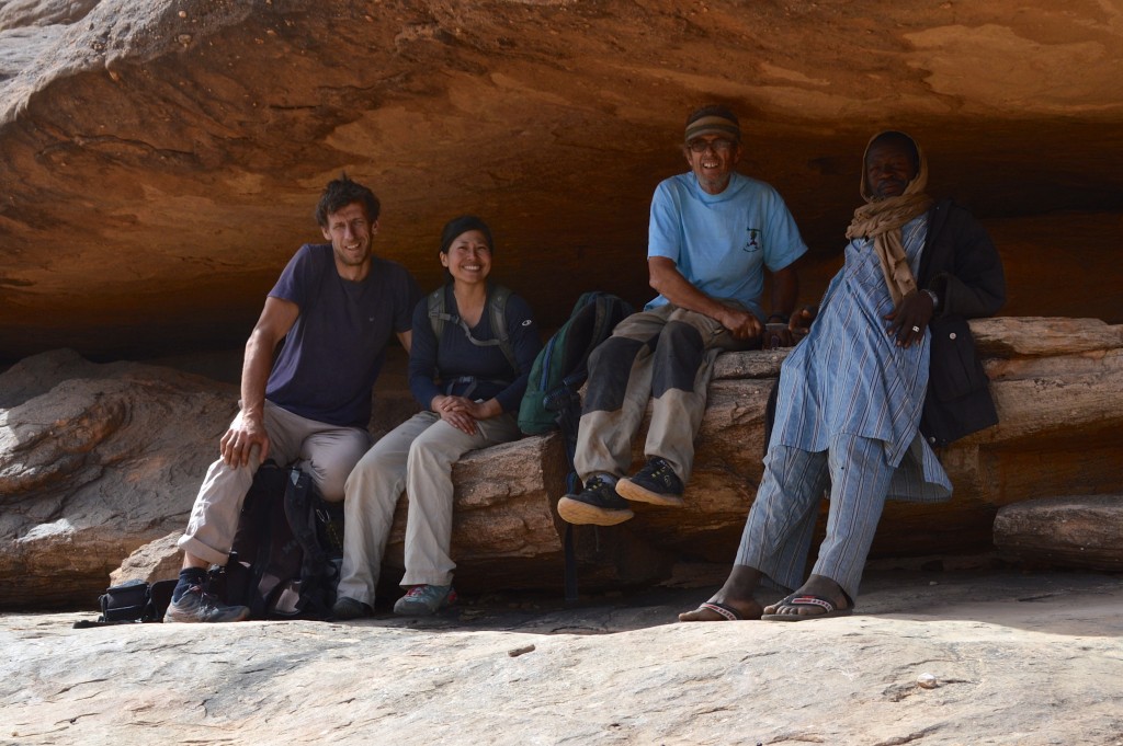
Salvador and Shirley on the summit of Aiguille Panoramix. The “backside” of the summit offers an exposed 3rd class scramble on the final short pitch (Dec. 2015).
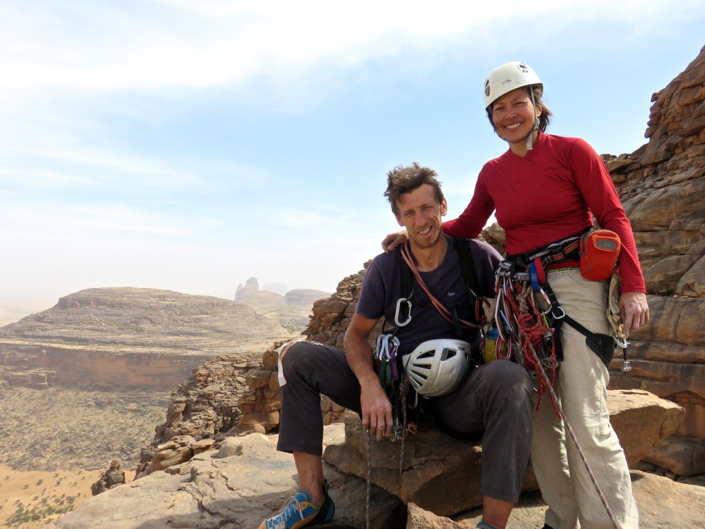
Summit of Aiguille Panoramix. Photo by Salvador (Dec. 2015).
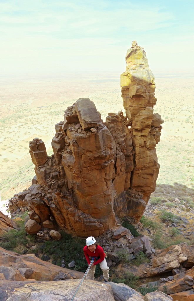
Shirley on one of the raps down (Dec. 2015).
Some other cool looking towers in the area (Dec. 2015).
Salvador and Shirley hiking back down to Grimari-Dapana after our climb (Dec. 2015).
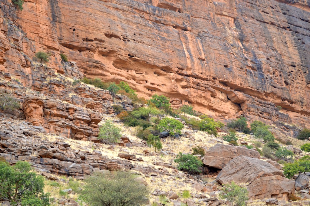
The long abandoned cliff-side dwellings above the village of Youna (Dec. 2015).
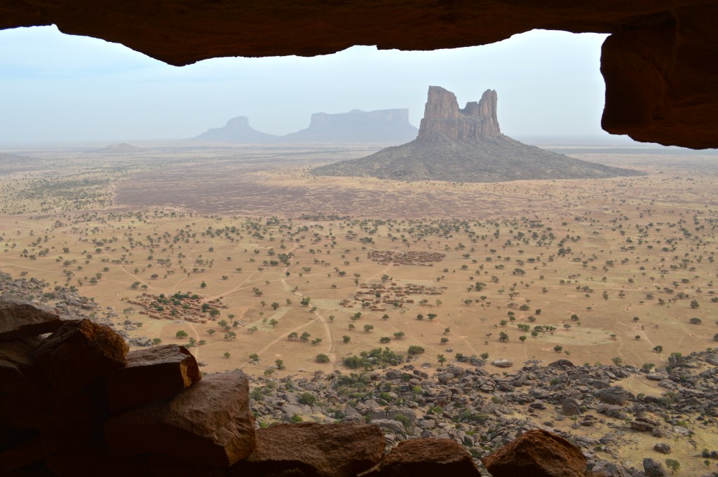
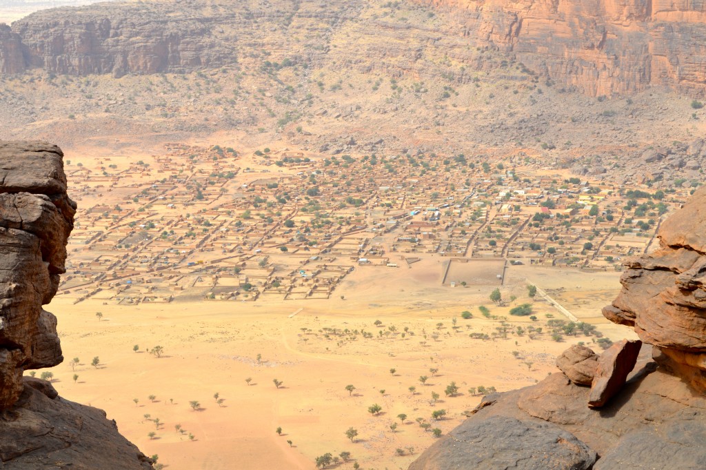
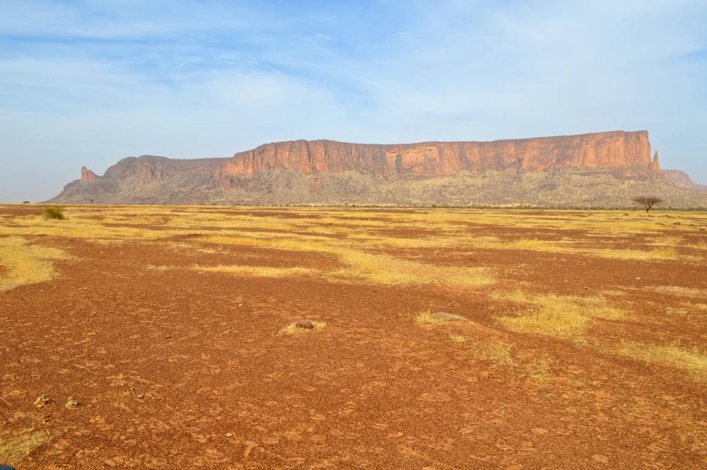
Youna-Inde Massif as seen from the old, escarpment village (ruins) of Youna (Dec. 2015).
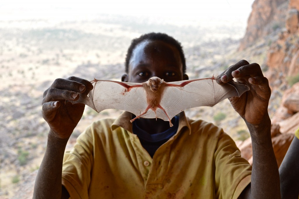
Some village kids from Youna accompanied us on a sightseeing hike to the old, cliff-side village ruins. Here they found some bats which were promptly dispatched…kids deprived of TV – that’s what happens!
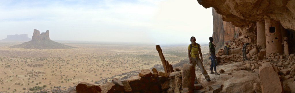
Youna-Inde Massif (Dec. 2015).
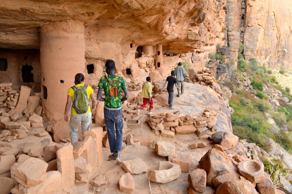
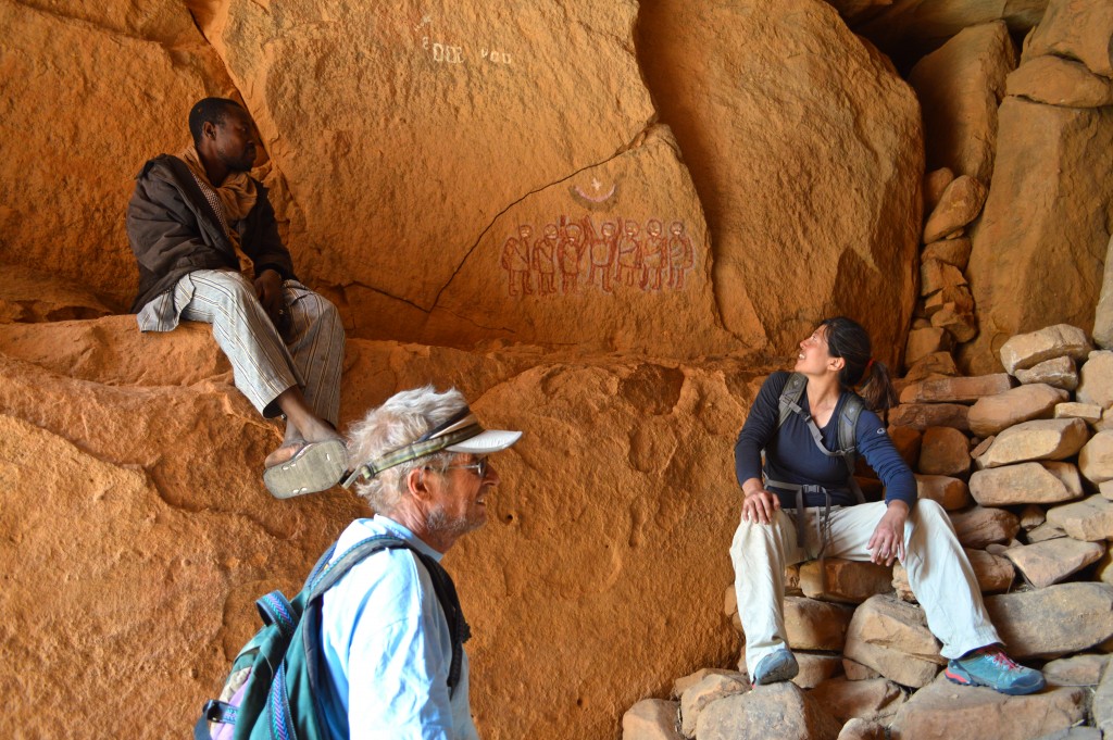
Hiking the old Youna village ruins (Dec. 2015).
A zebu portrait (Dec. 2015).
Another chicken making the ultimate sacrifice to satiate our hunger. This one lived in the village of Youna (Dec. 2015).
View of Youna-Inde Massif from our house in the village of Youna (Dec. 2015).
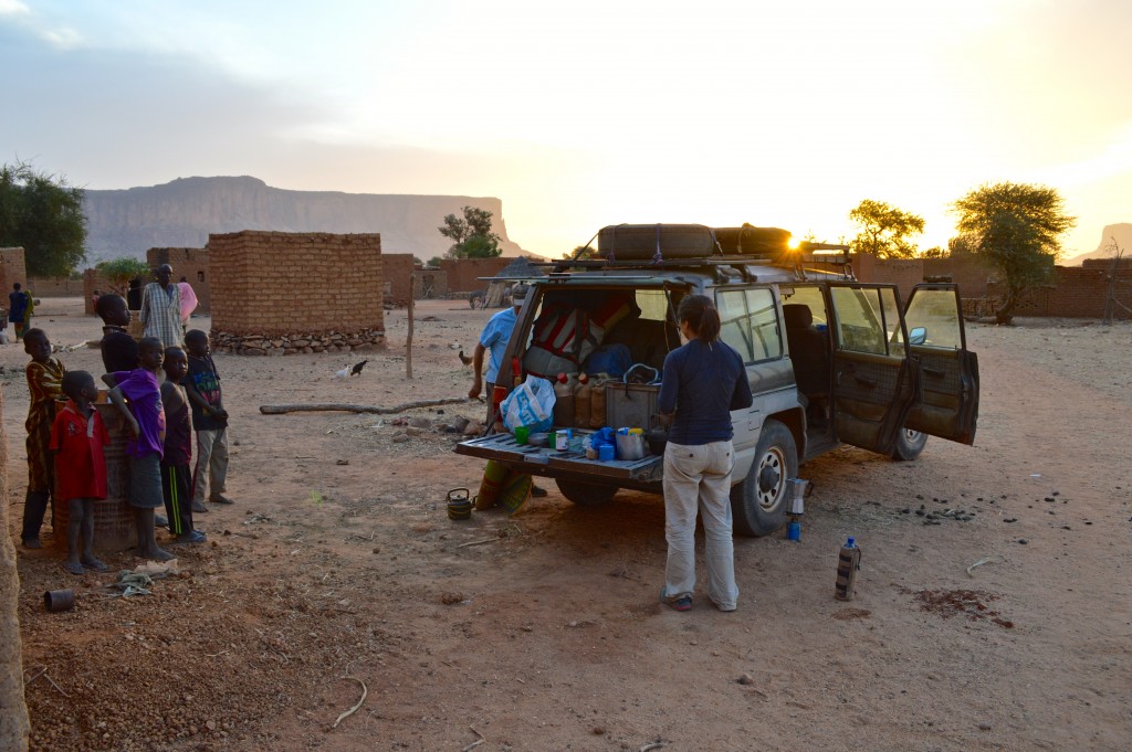
Another breakfast on the tailgate. This one in Youna. The crowd of onlookers (village kids) is just beginning to gather (nowhere near its usual peak).
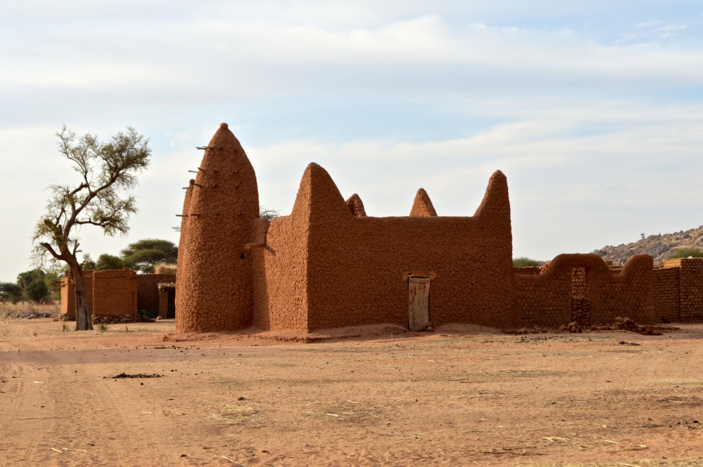
Another nice looking mosque. This one in the village of Loro at the start of the “backside” hiking trail up to mountaintop village of Boni-Koyo (Dec. 2015).
A pinnacle above the village of Loro (Dec. 2015).
In the village of Loro (Dec. 2015).
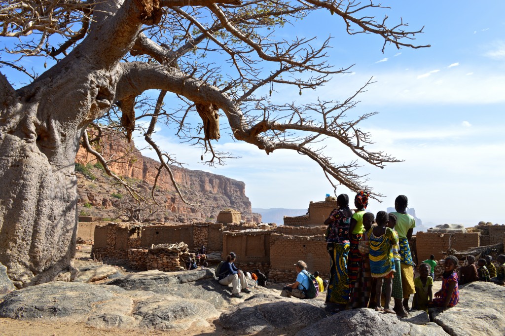
Shirley and Salvador waiting for our village guide under the baobab tree at the center of Boni Koyo (Dec. 2015).
Salvador and Shirley checking out a stalk of millet in the mountaintop village of Boni-Koyo (Dec. 2015).
We arrived in Boni Koyo on the day of a wedding. People were preparing a dowry of the staple grain millet (Dec. 2015).
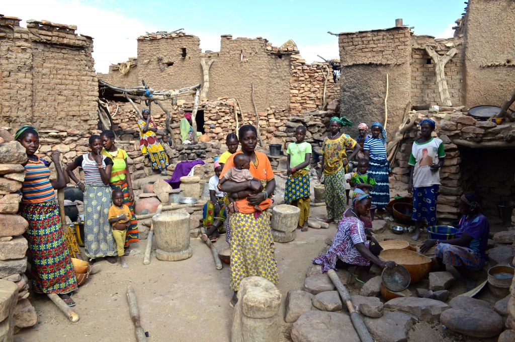
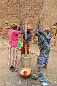
Women of Boni Koyo pounding millet in the wooden mortar and pestle “devices” – a labor intensive process (Dec. 2015).
Boni Koyo and Youna Inde Massif in the background (Dec. 2015).
Group photo with our local guide from Boni Koyo (never got the gentleman’s name but he is an artist).
View of the town of Boni from the edge of the high plateau where Boni Koyo is located. We were told that it’s best not to go there (Dec. 2015).
We did however descend part way down the scrambly trail that connects Boni and Boni Koyo (Dec. 2015).
The access to the village (from the side of the town) can be closed off in times of trouble. Here our guide (who’s a painter) is showing off “the gate” with some of his art on it (Dec. 2015).
Shirley and Salvador hiking through Boni Koyo (Dec. 2015).
More Boni Koyo sights including the central Baobab tree (Dec. 2015).
Women pounding millet. Click photo for a quick video (Dec. 2015).
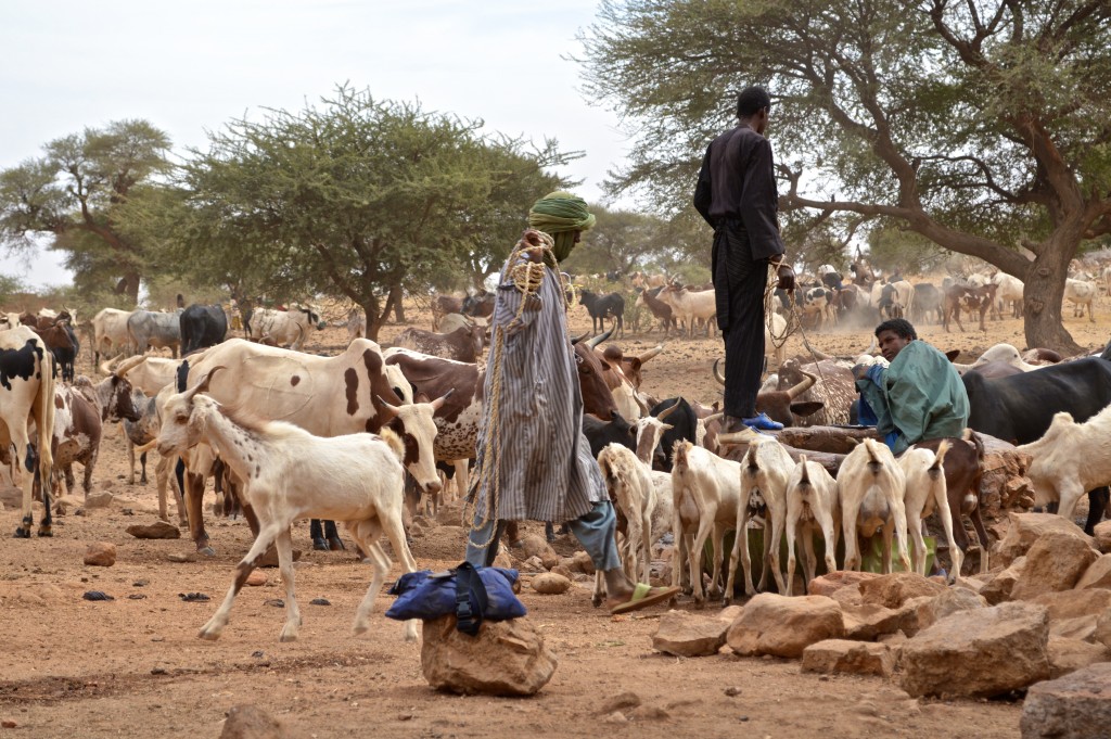
Men drawing water from a well (Dec. 2015).
Back down in the village of Loro (Dec. 2015).
We then drove to the base of Youna-Inde pinnacle for a quick lunch (Dec. 2015).
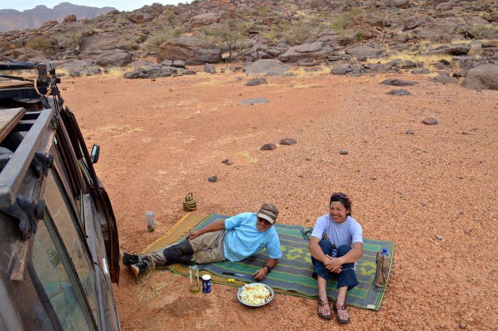
Salvador and Shirley enjoying our cabbage salad lunch. Actually quite good – we’ve made it at home since – and, unlike a lettuce-based salad, this one is nearly sterile. By the way, that’s olive oil and not white wine. Click photo for a quick video.
Shirley and Salvador preparing a lunch at the foot of the Youna-Inde Massif.(Dec. 2015).
Driving towards the village of Youna where we’ll spend the night (Dec. 2015).
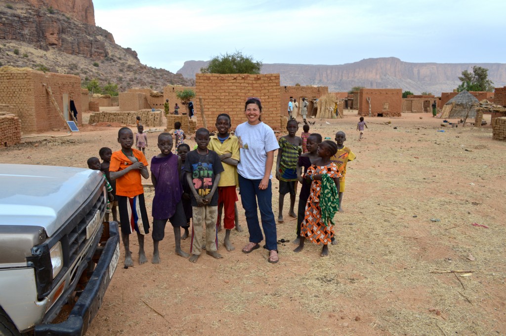
Shirley and some of the kids of Youna village – our home for two nights (Dec. 2015).
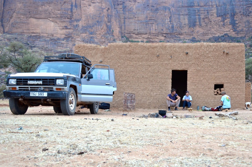
The village elder of Youna offered us an unoccupied house (newly built for a new couple who were yet to move in). Here we are enjoying our villa and the 3 hand-carved “camp” stools we bought (Dec. 2015).
Go to La Fiesta De Los Fetiches.
Go back to Mali.